The African Union (AU) has recently endorsed the ‘Correct the Map’ campaign. This campaign aims to replace the Mercator map projection with more accurate alternatives like the Equal Earth projection. The move marks long-standing concerns about how the Mercator map distorts the size of continents, especially Africa, and the symbolic consequences of this distortion.
Background of the Mercator Projection
The Mercator projection was created in 1569 by Gerardus Mercator, a Flemish cartographer. It was designed to aid navigation by showing rhumb lines—paths of constant compass bearing—as straight lines. This was a major advantage for sailors plotting courses. However, this came at the cost of distorting the size of landmasses. Areas near the poles appear larger than reality, while equatorial regions like Africa appear smaller.
Distortion Effects on Africa and Other Continents
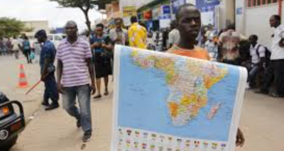
Africa, which is about 30 million square kilometres, appears much smaller than it actually is on Mercator maps. Greenland, which is 14 times smaller, often looks comparable in size. Europe and North America also appear inflated. This distortion has contributed to a skewed global perception, making Africa seem less . Critics argue this has reinforced historical marginalisation and colonial narratives.
Why Are Maps Distorted?
Flattening the globe onto a flat surface requires compromises. No projection can perfectly preserve area, shape, distance, and direction simultaneously. The Mercator projection preserves angles and shapes locally but sacrifices area. Other projections like the Equal Earth preserve area but distort shapes. Orthographic projection shows the Earth as seen from space but only one hemisphere at a time, compressing edges.
Alternatives to Mercator Projection
The Equal Earth projection, developed in 2018, preserves the relative size of continents, showing Africa much larger and more accurate than Mercator. It does distort shapes slightly. The Gall-Peters projection, popularised in the 1970s, also preserves area but stretches continents vertically. These alternatives aim to offer fairer representations of the world’s geography.
Political and Social Implications
Maps shape how people perceive the world. The Mercator map’s distortion has been described as a political tool that aided colonial attitudes by making Africa appear small and less important. The AU’s endorsement of map reform is part of a broader effort to reclaim dignity and correct historical misrepresentations. Campaigns seek to influence education, media, and digital platforms.
Challenges to Changing Map Usage
Despite growing support, replacing the Mercator projection is difficult. It is deeply embedded in education, media, and online tools. Changing it requires updating textbooks, redesigning curricula, and modifying digital interfaces. Some organisations like the World Bank, National Geographic, and NASA have adopted alternatives, but widespread change will take time.
Global Adoption Trends
Google Maps introduced a 3D globe view in 2018 to reduce Mercator’s dominance, but its mobile app still defaults to Mercator. The United Nations Committee on Global Geospatial Information Management has been petitioned to adopt the Equal Earth projection. The AU’s backing is the most institutional support for this global shift toward more accurate map projections.
Questions for UPSC:
- Taking the example of map projections, discuss how technological tools influence political and social perceptions globally.
- Examine the challenges and implications of replacing entrenched systems like the Mercator projection in education and media.
- Analyse the role of cartography in colonial expansion and its continuing impact on post-colonial societies.
- With suitable examples, discuss the importance of geographical accuracy in global policymaking and international relations.