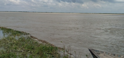
Originates at an altitude of 7,132 m in Tibet near Mount Kanchenjunga. Major tributaries are Son, Budhi Gandak, Bhutahi Balan and Kamla. Known as “River of Sorrow” due to devastating floods causing huge damage.
- Prone to change course due to very high silt carry (second globally after Yellow river in China)
Significance of Kosi River
- Vital source of irrigation and livelihoods supporting agriculture and livestock
- Rich alluvial soil aids cultivation of rice, maize, wheat and pulses
- Aids inland navigation and powers hydroelectric projects generating electricity
- Abundant natural resources including dolomite, mica and semi-precious stones
Key Statistics
- Length: 720 km (Tributaries – 1,072 km)
- Catchment area: 61,910 sq km
- Average water discharge: 2,166 cumec (cubic meter per second)
- Flood prone area: Over 25 lakh hectares
Major Tributaries of Kosi River
The Son River
- Rises in Madhya Pradesh and drains parts of MP, UP and Bihar
- Confluences with Kosi in Kursela (Katihar district, Bihar)
- Length – 784 km, Catchment – 71,259 sq km
- Prone to floods, change course causing huge damage like 2008 Kusaha incident
The Budhi Gandak River
- Originates at Basantpur in Trihut hills (West Champaran)
- Tributaries are Banganga, Madar, Tharthari, South Koel
- Joins Kosi near Rampur in Supaul district
- 266 km long with a catchment area of 3,Im280 sq km
The Bhutahi Balan River
- Rises from Someshwar hills of Nepal, flows through Bihar plains
- Confluences with Kosi near Simariya ghat in Bihar’s Purnea district
- Drought prone, home to endangered Gangetic dolphins
The Kamla River
- Originates in Nepal and drains through Jaynagar in Bihar
- Joins Kosi upstream of Barahkshetra ghat near Natwar village
- Prone to change course during floods causing huge damage
Major Floods in Kosi River
- 1730, 1797, 1816, 1823, 1849, 1854: Massive floods, high casualties
- 1863: Exceptionally severe flood after 99 years with huge loss
- 2008: River broke its embankments at Kusaha, displaced 50 lakh people
- 2016: Severe floods submerged lakhs of hectares of land, damaged crops
Flood Control Measures on Kosi
- Construction of embankments from Baltara to Kursela in Bihar
- India-Nepal project for building high dams, reservoirs to tackle floods
- Dredging river for smooth flow and increased water retaining capacity
- Upgradation of flood forecasting systems for timely warnings and preparedness
| Kosi River Tributaries Key Statistics | ||
| Name | Length | Catchment Area |
| Son | 784 km | 71,259 sq km |
| Budhi Gandak | 266 km | 3,780 sq km |
| Bhutahi Balan | 352 km | 5,670 sq km |
| Kamla | 130 km | 6,612 sq km |
Agriculture Dependence
- 50% population of Kosi basin relies on agriculture for food and livelihood
- Paddy the main crop, followed by maize, wheat, pulses and oil seeds
- Lowland productive but drought prone, limited irrigation facilities
Water Resources Projects
- Kosi Barrage at Bhimnagar regulates flow for irrigation in Bihar
- Canals taking off from barrage provide irrigation benefits in Mithilanchal region
- Kamla dam project proposed to control floods, enable ground water recharge
The wide extent of the Kosi river network calls for area-specific interventions across domains of agriculture, livelihoods, water conservation and flood control for enabling stability and prosperity.
- The Kosi River holds tremendous potential for supporting livelihoods and economic growth but has also been the source of recurring misery due to catastrophic floods.
- Comprehensive mechanisms encompassing dams, embankments coupled with advanced warning systems are required to control flood damage along the Kosi and its major tributaries.