The Indian Space Research Organisation (ISRO) has released the Landslide Atlas of India, which identifies the landslide-prone regions of the country. This article will discuss the significance of the Landslide Atlas of India and how it can help in mitigating the impacts of landslides.
Understanding Landslides:
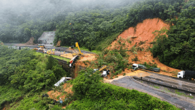
Landslides are natural disasters that occur when a mass of rock, earth, or debris moves down a slope due to gravity. They are triggered by various factors such as heavy rainfall, earthquakes, snowmelting, flooding, and human activities such as deforestation, mining, and construction. Landslides can be classified into different types based on the type of materials involved, type of movement of the material, and type of flow of the material. Understanding the types of landslides is crucial for developing appropriate measures to mitigate their impacts.
The Landslide Atlas of India:
The Landslide Atlas of India is a comprehensive database of landslide-prone regions of India. The atlas is mainly event-based and season-based, covering the period from 1998 to 2022. The regions covered in the atlas include the Himalayas and the Western Ghats, which are known for their rugged terrain and high rainfall. The atlas has identified the landslide hotspots in the country and categorized them based on the frequency of landslides.
Significance of the Lands
The Landslide Atlas of India is significant for several reasons. First, it provides a comprehensive database of landslide-prone regions of the country, which can help in identifying vulnerable areas and developing appropriate measures to mitigate their impacts. Second, the atlas can be used for developing early warning systems for landslides, which can help in reducing the loss of life and property
Last Modified: February 20, 2024