NASA’s PACE satellite has achieved the ability to detect nitrogen dioxide (NO2) pollution at a scale fine enough to isolate emissions from individual factories and highways. This advancement allows detailed mapping of NO2 plumes over urban areas like Los Angeles. The new dataset began coverage on 5 March 2024 and is publicly available on NASA’s Earthdata platform.
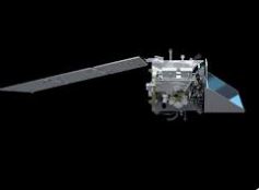
PACE’s Instrument and Data Processing
PACE’s Ocean Color Instrument (OCI), originally designed to monitor oceans and aerosols, was adapted to detect NO2 using machine learning techniques. The software was trained with reference data from the European TROPOMI satellite, enabling PACE to recover NO2 signals at a finer spatial resolution. Each measurement pixel covers roughly one square mile, allowing the separation of nearby emission sources.
Pollution Detection and Validation
PACE’s sharper NO2 maps distinguish emission sources such as highway corridors, ports, and industrial facilities with greater clarity than previous satellites. Validation against ground-based NO2 measurements shows PACE and TROPOMI readings are 10–20% lower than actual concentrations. Validation currently applies mainly to clear-sky conditions and areas with strong pollution signals.
Applications and Limitations
The detailed NO2 data supports health research by linking pollution exposure to specific locations rather than broad regions. The dataset includes ozone columns and quality flags to indicate cloud cover and measurement uncertainties. Limitations exist over water bodies due to surface reflection variability and instrument viewing angles, affecting data accuracy in oceanic regions.
Complementary Missions and Future Prospects
PACE operates alongside NASA’s TEMPO satellite, which provides hourly NO2 observations over North America. Combining PACE’s high spatial resolution with TEMPO’s temporal coverage enables tracking of pollution dispersion in near real-time. Future improvements aim to enhance water-surface algorithms and expand validation for broader applications in air quality monitoring and environmental planning.
What to Study for UPSC Exams?
- Satellite Remote Sensing Techniques
- Atmospheric Pollution Monitoring
- Machine Learning in Environmental Science
- Air Quality and Public Health Policies
Satellite Remote Sensing Techniques
Satellite remote sensing uses sensors aboard satellites to collect data about Earth’s surface and atmosphere without physical contact. It includes passive sensors detecting reflected sunlight and active sensors emitting signals like radar. Applications span weather forecasting, land use mapping, and environmental monitoring. Spatial resolution varies from meters to kilometers, influencing data detail. Calibration and atmospheric correction are critical for accuracy.
Atmospheric Pollution Monitoring
Atmospheric pollution monitoring tracks pollutants like NO2, SO2, and particulate matter using ground stations and satellites. Satellite instruments measure absorption and scattering of sunlight to identify gas concentrations. Data aids in tracking pollution sources, transport, and trends globally. Challenges include cloud interference and differentiating surface from atmospheric signals. Monitoring supports regulatory compliance and health risk assessments.
Machine Learning in Environmental Science
Machine learning applies algorithms to analyze complex environmental data for pattern recognition and prediction. It enhances satellite data interpretation, climate modeling, and species distribution mapping. Techniques include supervised learning for classification and unsupervised learning for anomaly detection. ML accelerates processing of large datasets and improves accuracy by integrating diverse data sources. Overfitting and data bias remain challenges.
Air Quality and Public Health Policies
Air quality policies regulate pollutant emissions to protect public health, targeting contaminants like ozone, NO2, and PM2.5. Standards are set by agencies such as WHO and EPA based on epidemiological evidence. Policies include emission limits, monitoring requirements, and public advisories. Implementation varies globally due to economic and technological factors. Health impacts include respiratory and cardiovascular diseases linked to pollutant exposure.
Last Modified: April 12, 2026