On 16 June 2026 the National Capital Region Planning Board cleared the NCR Regional Plan 2041 for the 55,083 sq km NCR, proposing four new greenfield “Namo Cities” within the region.
Key Decisions
- Plan Clearance: NCR Regional Plan 2041 approved by NCRPB to guide development over the next two decades.
- Extent: Geographical extent of NCR remains unchanged at 55,083 sq km.
- New Urban Centres: Four greenfield “Namo Cities” (also called “Namo Nodes”) proposed, one in each participating jurisdiction—Delhi, Haryana, Uttar Pradesh and Rajasthan.
- Funding: Central assistance of ₹5,000 crore over five years, including a ₹1,000 crore grant, earmarked for the four cities.
Namo Cities — Design and Purpose
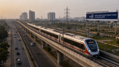
- Transit-Oriented Development (TOD): Planned as TODs located along Namo Bharat Regional Rapid Transit System (RRTS) corridors.
- Greenfield Nodes: New developments on undeveloped land to accommodate planned urban growth and decentralised development.
- Selection Mechanism: Each state to host one city chosen via a competitive challenge process based on state proposals.
Spatial & Demographic Projections
- Population Projection: NCR population projected from ~7.86 crore currently to about 14.73–15.00 crore by 2041.
- Urban Concentration: Majority of growth expected in urban centres.
Process & Timeline
- Inter‑governmental Review: Sub‑committee of Union and state senior officials constituted to submit final report by 15 August 2026.
- Final Draft: Regional Plan 2041 final draft expected to be released at a board meeting in December 2026.
IASPOINT Booster Facts
- NCRPB Legal Basis: National Capital Region Planning Board constituted under the National Capital Region Planning Board Act, 1985.
- Implementing Agency (RRTS): Namo Bharat RRTS is implemented by the National Capital Region Transport Corporation (NCRTC).
- TOD Concept: TOD clusters higher density, mixed land use and pedestrian access around high‑capacity transit to increase public transport share.