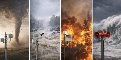
India faces frequent extreme weather events like cyclones, floods, heatwaves, and droughts. To tackle these risks, the India Meteorological Department (IMD) developed the Multi-Hazard Early Warning Decision Support System (MHEW-DSS). Launched in January 2024 under Mission Mausam, this digital platform enhances real-time weather forecasting and disaster preparedness across the country.
Development and Core Objectives
MHEW-DSS is an indigenous, integrated forecasting system. It uses open-source technology and combines satellite, radar, and ground data. The system automates over 90% of data processing, improving forecast accuracy and lead time from 5 to 7 days. It supports impact-based warnings tailored for sectors like agriculture, fisheries, energy, and transport. The goal is to enable quick, clear, and actionable weather alerts to reduce disaster losses and protect lives.
Key Features and Technological Innovations
The system re-engineers the forecasting workflow using Geographic Information System (GIS) maps and ensemble modelling. It automates data quality checks and integrates multiple weather models for consensus forecasts. Forecast preparation time has reduced by half, enabling faster dissemination. The platform supports hyper-local forecasts through Mausamgram, covering over 1.5 lakh pin codes and 6.2 lakh villages. It sends alerts via SMS, apps, APIs, and media to reach communities and authorities efficiently.
Institutional Framework and Sectoral Impact
MHEW-DSS is operated by the IMD under the Ministry of Earth Sciences. It works closely with agencies like the National Disaster Management Authority and state disaster bodies. The system aids cyclone evacuation, heatwave response, renewable energy planning, water management, and health preparedness. It supports sustainable farming through agromet advisories, boosting farmers’ income. The digital approach saves costs, manpower, water, electricity, and reduces environmental impact.
National and Global Recognition
MHEW-DSS has earned national awards such as the National Award for e-Governance 2025 and international honours including the UNDRR Sasakawa Award 2025. As a Regional Specialized Meteorological Centre, India provides early warnings to neighbouring countries. The system strengthens regional cooperation and global disaster risk reduction efforts. It marks India as a leader in multi-hazard early warning technologies.
Topics for Prelims:
MHEW-DSS System
- Developed by India Meteorological Department under Mission Mausam.
- Automates 90% of weather data processing and integrates multiple models.
- Extends forecast lead time from 5 to 7 days.
- Provides sector-specific impact-based warnings.
- Uses GIS mapping and hyper-local forecasts through Mausamgram.
Institutional and Sectoral Roles
- Operated by IMD under Ministry of Earth Sciences.
- Supports disaster management agencies like NDMA and SDMAs.
- Aids sectors – agriculture, health, energy, fisheries, water management.
- Enhances cyclone evacuation and heatwave response.
- Reduces costs, manpower, and environmental footprint.
Questions for Mains:
- Discuss in the light of India’s diverse geography how integrated early warning systems like MHEW-DSS enhance disaster risk reduction. [GS-III-Environment & DM]
- Analyse the role of digital transformation in meteorological services with examples from India’s MHEW-DSS initiative and its impact on governance. [GS-II-Governance]
- Examine the challenges and opportunities in regional cooperation for weather forecasting and disaster management, taking India’s role as a Regional Specialized Meteorological Centre as a case study. [GS-II-International Relations]
- With suitable examples, discuss the significance of impact-based forecasting in agriculture and rural livelihood protection in India. Critically discuss how such systems can be improved further. [GS-III-Economic Development]
Topics for Prelims:
India Meteorological Department (IMD)
- Established in 1875, principal weather agency of India.
- Operates under Ministry of Earth Sciences.
- Provides weather forecasts, warnings, and climate services nationwide.
- Leads MHEW-DSS development and operations.
- Serves disaster management, agriculture, aviation, energy and health sectors.
Mission Mausam
- Launched in 2024 to strengthen weather forecasting and early warning.
- Focuses on improving forecast accuracy and lead time.
- Supports integrated data assimilation and modelling capabilities.
- Enhances disaster preparedness for cyclones, heatwaves, and floods.
- Promotes weather literacy and capacity building among stakeholders.
Mausamgram Portal
- Web-based hyper-local weather forecasting platform by IMD.
- Covers over 1.5 lakh pin codes and 6.2 lakh villages.
- Delivers forecasts up to 10 days with multiple time intervals.
- Accessible via IMD website, mobile app, and APIs.
- Supports last-mile dissemination to farmers, fishermen, and local officials.
Answer Hints:
1. Discuss in the light of India’s diverse geography how integrated early warning systems like MHEW-DSS enhance disaster risk reduction. [GS-III-Environment & DM]
- India’s diverse geography includes long coastlines, Himalayas, floodplains, and arid zones, making it prone to multiple hazards (cyclones, floods, droughts, landslides, heatwaves).
- MHEW-DSS integrates multi-source data (satellite, radar, ground stations) providing real-time, location-specific forecasts suited to varied terrains and hazard types.
- Impact-based warnings allow tailored alerts for different regions and sectors, enhancing preparedness and reducing losses.
- GIS mapping and hyper-local forecasts (via Mausamgram) ensure last-mile dissemination to vulnerable communities across diverse geographies.
- Longer forecast lead time (7 days) and faster dissemination enable timely evacuation and resource mobilization, critical in geographically complex areas.
- Automated data processing and multi-model consensus improve accuracy, essential for managing risks in heterogeneous environments.
2. Analyse the role of digital transformation in meteorological services with examples from India’s MHEW-DSS initiative and its impact on governance. [GS-II-Governance]
- MHEW-DSS automates over 90% of data processing, reducing manual errors and improving forecast speed and accuracy.
- Use of GIS, ensemble forecasting, and webGIS platforms enables real-time, user-friendly weather information dissemination across sectors.
- Digital workflows reduce manpower costs (₹57.6 crore saved annually) and environmental footprint (paper and energy savings), increasing governance efficiency.
- Interoperability and scalability allow seamless data sharing among ministries, disaster agencies (NDMA, SDMAs), and stakeholders, improving coordination.
- Sector-specific advisories (agriculture, health, energy) support evidence-based decision-making and policy formulation.
- Enhanced transparency and accountability through open data processes and multiple dissemination channels (SMS, apps, APIs) strengthen public trust in governance.
3. Examine the challenges and opportunities in regional cooperation for weather forecasting and disaster management, taking India’s role as a Regional Specialized Meteorological Centre as a case study. [GS-II-International Relations]
- India, as RSMC, provides forecasting and early warnings to neighboring countries (Bangladesh, Maldives, Myanmar, etc.), enhancing regional disaster preparedness.
- Challenges include data sharing reluctance, technical disparities, and differing disaster response capacities among countries.
- Opportunities lie in harmonizing standards, joint capacity building, and technology transfer through WMO and ESCAP/WMO panels.
- MHEW-DSS’s interoperable and replicable architecture facilitates regional integration and multi-hazard early warning dissemination.
- Regional cooperation strengthens collective resilience against transboundary hazards like cyclones and floods in the North Indian Ocean region.
- India’s leadership role enhances diplomatic ties and promotes shared climate risk management frameworks in South Asia and Asia-Pacific.
4. With suitable examples, discuss the significance of impact-based forecasting in agriculture and rural livelihood protection in India. Critically discuss how such systems can be improved further. [GS-III-Economic Development]
- Impact-based forecasts translate weather data into actionable advisories for farmers, aiding sowing, irrigation, and harvesting decisions (e.g., agromet advisories under MHEW-DSS).
- Farmers using advisories report 52.5% higher income; rain-fed districts could gain ₹13,331 crore annually, showing livelihood protection and economic benefits.
- Sector-specific alerts help fishermen, daily wage earners, and transport workers plan activities, reducing weather-related losses.
- Improved forecasts during cyclones enable timely evacuations, protecting rural communities and assets.
- Improvements needed – enhance last-mile connectivity, increase awareness and training, integrate indigenous knowledge, and expand mobile and vernacular language dissemination.
- Further integration with local institutions (panchayats, Krishi Sakhi) and use of AI/ML for localized prediction can increase accuracy and adoption.