
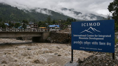
Communities across the Hindu Kush Himalaya (HKH) now face a volatile monsoon: prolonged dry spells interrupted by short, intense rain events, rising temperatures and accelerated glacier melt. ICIMOD’s Monsoon Outlook 2026 warns of below‑normal seasonal rainfall but elevated localised flood and glacier‑related hazards, requiring integrated, multi‑hazard preparedness.
What is the issue
Core problem
HKH will likely see below‑normal seasonal rainfall alongside episodic extreme rainfall. Higher temperatures accelerate glacier and snowmelt in basins such as the Indus, Ganga and Brahmaputra. The concurrence of intense precipitation, rapid melt, unstable slopes and fast rising rivers creates compound, cascading disasters.
Why it matters for governance, economy and society
- Water security: Altered seasonal flows and increased melt change availability for irrigation, drinking water and hydropower.
- Infrastructure and development: Roads, bridges and hydro projects are at higher risk; recent flash floods affected the 540 MW Kwar project and local transport links.
- Livelihoods and poverty: Agriculture, pastoralism and mountain tourism suffer from droughts, floods and displacement.
- Disaster management and fiscal risk: Increased frequency of rapid‑onset events raises relief and reconstruction costs for central and state budgets.
- Security and migration: Recurrent hazards can cause temporary or permanent shifts in population, stressing urban services and social stability.
Geography and climatic drivers
The HKH is the source region for major South Asian rivers. Climatic drivers include a strengthening El Niño, changes in monsoon dynamics, and persistent above‑normal temperatures. These factors produce fewer seasonal rains on average but more intense, localised downpours and faster glacier ablation.
Nature of risks and cascading hazards
- Flash floods and cloudbursts: Short, intense rainfall triggers sudden floods in steep catchments.
- Landslides and slope failure: Saturation from intense rains and meltwater destabilises slopes.
- Glacial hazards (GLOFs): Enhanced melt and moraine destabilisation increase the likelihood of glacial lake outburst floods.
- Compound events: Concurrent droughts and flash floods create simultaneous risks for water supply, agriculture and emergency response.
Recent evidence and authoritative statements
- Observed events: Cloudburst floods in Gilgit‑Baltistan and intense rainfall floods in Arunachal Pradesh and Kishtwar.
- ICIMOD findings: Monsoon Outlook 2026 projects below‑normal seasonal rainfall but high localised hazard risk.
- Expert position: ICIMOD hydrologist Manish Shrestha: hazards now interact to create cascading disasters. Disaster specialist Saswata Sanyal: seasonal averages do not predict local extremes; less seasonal rain does not equal lower flood risk.
Socio‑economic and developmental implications
Reduced seasonal rainfall and episodic extremes will shift cropping calendars and irrigation demand. Hydropower generation faces variable inflows and physical damage risk. Road and market disruptions hinder supply chains. Repeated disaster losses deepen poverty and increase insurance and fiscal burdens. Vulnerable mountain settlements face displacement and loss of traditional livelihoods.
Challenges in preparedness and response
- Forecast limitations: Seasonal forecasts indicate averages but cannot predict site‑scale extremes reliably.
- Fragmented hazard management: Existing systems often treat drought, floods, landslides and glacier hazards separately.
- Data gaps: Sparse in‑situ glacier, hydrological and slope‑stability monitoring across high altitude catchments.
- Capacity constraints: Local institutions and communities lack trained personnel, evacuation routes and shelters adapted for compound hazards.
- Coordination deficits: Transboundary river basins need timely data sharing for upstream‑downstream risk management.
Institutional and policy context
National frameworks relevant to India include IMD (weather forecasts), Central Water Commission (river monitoring), NDMA and state disaster management authorities. ICIMOD calls for integrated early warning systems that link rainfall forecasts, glacier‑melt monitoring, river gauge data and slope‑stability alerts. Policy instruments must align disaster risk reduction with climate adaptation and development planning.
Role of science and technology
- Monitoring: Enhance glacier mass balance, hydrological gauging and meteorological networks in high altitude zones.
- Remote sensing and modelling: Use satellite imagery, LiDAR, GIS and coupled hydrological‑glacier models for localised risk mapping and GLOF detection.
- Early warning: Multi‑parameter EWS combining rainfall thresholds, rapid melt indices and slope‑failure sensors with community alert channels.
- Decision support: Real‑time dashboards for authorities and standard operating procedures for trigger‑based responses.
Transboundary and regional cooperation
River basins cross national borders; coordinated monitoring and data sharing among India, Pakistan, China, Nepal and Bhutan is essential. Mechanisms can include bilateral protocols, regional platforms (e.g., ICIMOD, BIMSTEC engagement), joint research, and shared early warning protocols for downstream alerts.
Way forward: policy and operational measures
- Integrated multi‑hazard EWS: Develop systems that combine meteorological forecasts, glacier‑melt indices, river flows and slope sensors. Link early warnings to local contingency plans.
- Dual preparedness planning: Prepare simultaneously for prolonged dry spells (water conservation, drought‑resilient crops) and rapid floods (evacuation routes, flood‑resistant structures).
- Infrastructure resilience: Apply risk‑sensitive design for roads, bridges and hydropower; locate critical assets away from high‑risk corridors where feasible.
- Community engagement: Train local volunteers, maintain community hazard maps, practise evacuation and protect livelihoods through insurance and livelihood diversification.
- Data investment: Expand in‑situ monitoring, open data protocols, and support modelling capacity at national and regional centres.
- Policy integration: Mainstream HKH climate risk into land‑use planning, river basin management and national adaptation plans.
- Regional diplomacy: Negotiate data‑sharing agreements, joint GLOF monitoring and transboundary disaster response exercises.
Model Questions
1. Analyse how erratic monsoon patterns, rising temperatures and accelerating glacier melt in the Hindu Kush Himalaya create interconnected environmental challenges and affect downstream river basins. [GS-III: Environment & DM]
Erratic monsoon causes prolonged dry spells and intense localised rain. Higher temperatures accelerate glacier and snowmelt. Combined effects create flash floods, GLOFs and landslides, altering seasonal flows of Indus, Ganga and Brahmaputra. Consequences include water supply variability, irrigation stress, hydropower disruption, sedimentation, infrastructure damage and increased disaster response costs. Management requires integrated hydrological modelling, monitoring and basin‑scale planning.
2. Critically evaluate India’s disaster preparedness in light of ICIMOD’s call for integrated early warning systems for compound risks in the HKH. [GS-II: Governance]
India has institutional structures (IMD, CWC, NDMA, state DMAs) but faces gaps: limited high‑altitude monitoring, siloed hazard management and weak local capacity. ICIMOD’s call implies integrating meteorological, glacier, river and slope data, trigger‑based SOPs and community channels. Improvements needed in real‑time data sharing, capacity building at panchayat and state level, investment in sensors, and cross‑institutional protocols for multi‑hazard response.
3. Examine socio‑economic and developmental implications of climate‑driven erratic monsoons and glacial retreat in the HKH for communities across the Indian subcontinent. [GS-III: Economic Development]
Erratic monsoons and glacial retreat disrupt agriculture, reduce irrigation reliability and alter hydropower yields. Recurrent floods and landslides damage roads and markets, increase reconstruction costs and reduce tourism earnings. Vulnerable households face income loss, asset erosion and displacement. Macro effects include higher fiscal burdens for relief, insurance market stress and potential long‑term productivity losses in hill economies.
4. Discuss the role of scientific projections, technological interventions and regional cooperation in reducing risks from volatile monsoon seasons and glacier melt in the HKH. [GS-II: International Relations]
Scientific projections (seasonal outlooks and glacier studies) guide preparedness but must be downscaled for local use. Technologies—remote sensing, hydrological‑glacier models, sensors and real‑time dashboards—improve detection and warning. Regional cooperation enables cross‑border data exchange, joint GLOF monitoring and coordinated response. Diplomatic agreements and shared platforms (regional research and early warning mechanisms) are essential for downstream risk reduction.
Last Modified: July 7, 2026