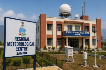
Union Minister for Science and Technology and Earth Sciences, Dr. Jitendra Singh, inaugurated India’s seventh Regional Meteorological Centre (RMC) in Jammu on World Environment Day, June 5, 2026. This newly established facility serves as the primary meteorological hub for Jammu and Kashmir, Ladakh, and Himachal Pradesh. It marks a structural shift by decentralizing northern India’s weather operations, which were previously managed entirely by RMC New Delhi. The facility is designed to improve localized forecasting accuracy and early warning systems across the ecologically vulnerable and strategically vital north-western Himalayan terrain.
Institutional Restructuring of the India Meteorological Department
The establishment of RMC Jammu changes the administrative layout of the India Meteorological Department (IMD) to better address mountain meteorology.
Decentralization of the Northern Region
Prior to this expansion, RMC New Delhi held operational jurisdiction over the entire northern belt of India. The restructuring divides these responsibilities among three distinct regional nodes to ensure location-specific analysis. Under this framework, RMC Jammu assumes direct control over Jammu and Kashmir, Ladakh, and Himachal Pradesh. The New Delhi centre retains oversight for Delhi, Haryana, and Punjab, while a upcoming facility in Lucknow manages Uttar Pradesh and Uttarakhand.
Academic and Inter-Agency Linkages
To strengthen high-altitude climate research, the operational framework integrates institutional partnerships with local universities and state divisions.
- University Collaborations: Memorandums of Understanding are signed with Sher-e-Kashmir University of Agricultural Sciences and Technology (SKUAST) Jammu, SKUAST Kashmir, and the Islamic University of Science and Technology.
- Whole-of-Government Approach: Joint data-sharing mechanisms exist between the IMD, the Department of Science and Technology, and local disaster management groups.
Specialized Forecasting and Early Warning Capabilities
The complex geography of the north-western Himalayas demands specialized meteorological services that differ from plain-terrain models.
Terrain-Specific Micro-Forecasts
The centre delivers customized district-level updates, city weather services, and localized mountain meteorology reports. It introduces dedicated short-range predictive products like Nowcast, which can provide location-specific tracking up to three hours in advance.
Mitigation of Meteorological Hazards
The primary function of RMC Jammu involves tracking and disseminating early warnings for extreme climatic events.
| Hazard Category | Operational Focus | Targeted Beneficiaries |
| Cloudbursts & Landslides | Real-time precipitation intensity monitoring | Himalayan villages, border road construction teams |
| Flash Floods & Snowfall | River basin catchment data and heavy accumulation modeling | Hydropower projects, transport networks |
| Avalanches | High-altitude snowpack stability monitoring | Security forces, high-altitude border outposts |
| Western Disturbances | Winter low-pressure system tracking | Regional transport networks, state planning bodies |
Sectoral Support
- Pilgrimages and Tourism: Separate forecasting mechanisms provide real-time updates for helicopter routes and weather conditions along the Shri Mata Vaishno Devi and Amarnath Yatra pilgrimage corridors.
- Aviation and Defense: Continuous atmospheric testing assists high-altitude military logistics, flight clearance, and border security operations.
- Agro-Meteorology: Weather advisories are tailored to distinct regional cropping patterns, handling challenges that range from subtropical mango cultivation in lower plains to temperate apple orchards in alpine zones.
Upgradation of Meteorological Infrastructure
The creation of RMC Jammu is supported by a multi-year expansion of observation systems under central initiatives.
Radar Deployment
In 2014, the region lacked specialized radar equipment. By 2026, four Doppler Weather Radars became operational at critical terrain points, including Jammu, Srinagar, Leh, and Banihal Top. Under the central “Mission Mausam” initiative, five more Doppler systems are planned for installation at Anantnag, Rajouri, Baramulla, Kishtwar, and Doda.
Surface Observation Network
The observation grid has expanded from basic facilities into automated telemetry units across remote zones.
| Instrument Type | 2014 Inventory Count | 2026 Operational Count |
| Automatic Weather Stations (AWS) | 13 Units | 25 Units |
| Automatic Rain Gauges (ARG) | 14 Units | 16 Units |
| Manual Observatories | Varies | 15 Units |
| Total Functional Observatories | 27 Units | 56 Units |
Recent high-altitude automated units have been deployed at Kargil, Ukhral in Ramban district, and the Mata Vaishno Devi Bhawan.
Seismological Upgrades
Beyond atmosphere tracking, the region’s earthquake monitoring layout has transitioned to digital networks. Five functional seismic stations map activity across Jammu, Kashmir, and Ladakh. These hubs feed real-time tectonic data into the National Centre for Seismology. A digital upgrade has been completed at the primary stations, an observatory opened at Udhampur, and another unit is planned for Kishtwar.
IASPOINT Booster Facts for UPSC
- Regional Meteorological Centres List: With the addition of Jammu, India now has seven functional RMCs. The other six centers are located in New Delhi, Chennai, Mumbai, Kolkata, Guwahati, and Nagpur.
- High-Altitude Cloud Physics Laboratory: India operates a unique high-altitude cloud physics facility at Nathatop, situated near Patnitop at an elevation of 10,000 feet. Developed in collaboration with Switzerland, it stands as India’s first and the world’s second such installation designed to investigate aerosol-cloud droplets in mountain zones.
- Mission Mausam: Launched by the Ministry of Earth Sciences, this initiative aims to improve weather prediction through advanced computational systems, artificial intelligence modeling, next-generation radars, and satellite constellations.
- Western Disturbances Origin: These extra-tropical storms originate over the Mediterranean Sea and the Atlantic Ocean. Driven by the subtropical westerly jet streams, they bring sudden winter precipitation to India’s northwest Himalayan zone.
- X-Band vs. S-Band Radar: X-band Doppler radars operate on shorter wavelengths (2.5-4 cm) and higher frequencies, making them highly effective for localized, high-resolution mountain terrain weather tracking, whereas S-band radars are used for longer-range coastal cyclone tracking.
