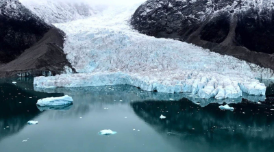
Researchers discovered glacier ice dating back at least 770,000 years beneath the permafrost on Bylot Island, Nunavut, in the Canadian Arctic. This discovery stands as one of the oldest preserved glacier remnants located outside the massive ice sheets of Greenland and Antarctica. The breakthrough research, initiated in 2009 by geomorphologist Daniel Fortier from the University of Montreal and supported by Polar Knowledge Canada, was published in the journal Geology. The study used advanced chronological modeling to trace past ecological conditions, though ongoing Arctic permafrost thaw threatens to degrade these ancient climate records.
Geochemical and Geological Context of the Discovery
The preservation of this ancient ice relies on the unique geological conditions of the Canadian Arctic. Permafrost acts as a natural cryospheric vault by remaining frozen for consecutive years and halting organic decay.
Stratigraphic Layering and Fossil Forest
The 770,000-year-old glacier ice directly overlies an ancient fossil forest bed. This underlying organic layer dates back between 2.4 million and 2.8 million years. This specific stratigraphic sequence offers a direct window into the transition between the warm Pliocene epoch and the early Pleistocene period.
Environmental Reconstruction Power
Analyses of the trapped atmospheric gases, ancient pollen, and plant macrofossils within the ice and underlying forest help scientists reconstruct ancient Arctic ecosystems. The samples indicate that the Arctic climate once supported dense vegetation and temperate forest ecosystems before global cooling initiated major cyclical glaciations.
The Science of Geomagnetic Reversals
To determine the precise age of the sub-permafrost ice, scientists paired traditional cryospheric dating with paleomagnetism. The primary chronological anchor for this discovery is the Brunhes-Matuyama geomagnetic reversal.
Mechanism of Magnetic Dating
When volcanic rocks cool or sediments settle, magnetic minerals like magnetite align themselves with the orientation of the Earth’s magnetic field at that specific time. This alignment locks in a permanent record of the planet’s magnetic polarity, creating a geological timeline that researchers can read millions of years later.
The Brunhes-Matuyama Event
The Brunhes-Matuyama reversal represents the most recent major total inversion of the Earth’s magnetic field. This event serves as a critical global stratigraphic marker for geologists, marking the formal boundary between the Early Pleistocene and Middle Pleistocene sub-epochs.
| Geomagnetic Property | Matuyama Epoch (Before Reversal) | Brunhes Epoch (After Reversal) |
| Polarity Type | Reversed Polarity | Normal Polarity (Current State) |
| Compass Alignment | Magnetic North needle pointed toward the South Pole | Magnetic North needle points toward the North Pole |
| Temporal Span | Began approximately 2.58 million years ago | Began 770,000 years ago and continues today |
Implications for Paleoclimate Research
The study of ancient ice remnants provides critical data for baseline climate modeling, helping scientists project future climate trajectories by looking at past atmospheric compositions.
Atmospheric Sampling
Ice cores trap ambient air bubbles from the exact period the ice formed. Testing these bubbles reveals the precise concentrations of greenhouse gases like carbon dioxide and methane during previous interglacial warm periods.
Cryospheric Vulnerability
The Arctic is warming at a rate multiple times faster than the global average. The rapid thawing of permafrost exposes these ancient, deeply buried ice structures to ambient temperatures, causing them to melt and permanently destroying unexamined paleoclimate records.
IASPOINT Booster Facts for UPSC
- Geomagnetic Reversals: The process where the Earth’s magnetic North and South poles swap positions. This is a recurring planetary phenomenon caused by complex fluid dynamics within the Earth’s liquid iron outer core, a process known as the geodynamo mechanism.
- Geomagnetic Excursions vs. Reversals: An excursion is a temporary, short-lived change in the magnetic field where the poles tilt away but return to their original positions. A reversal is a permanent, long-term flip across the entire planet.
- The Brunhes-Matuyama Boundary: Named after the French physicist Bernard Brunhes and the Japanese geophysicist Motonori Matuyama. The International Union of Geological Sciences (IUGS) officially recognizes this 770,000-year-old boundary as a key marker for the Middle Pleistocene stage.
- Bylot Island Geography: Located in the territory of Nunavut, Canada. It lies within the Arctic Archipelago and is largely situated inside the Sirmilik National Park, making it a critical site for circumpolar ecological monitoring.
- Pliocene-Pleistocene Transition: The Pliocene Epoch (5.3 to 2.58 million years ago) was generally warmer and wetter than today. The subsequent Pleistocene Epoch (2.58 million to 11,700 years ago) brought repeated glacial-interglacial cycles, driving the evolution of modern cold-adapted flora and fauna.