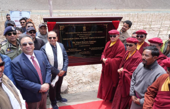
A 2.10-kilometer high-altitude irrigation canal called Mahey Tokpo-Raldho was inaugurated on 14 May 2026 in the Changthang region of Ladakh. Situated at an altitude exceeding 14,000 feet, the infrastructure project draws water from Yaya Lake to provide regular irrigation to nearly 100 acres of agricultural land in the Mahey area. The channel is engineered with reinforced structural features to survive the extreme freezing temperatures of the cold desert. Alongside the canal inauguration, local authorities launched a large-scale plantation drive of 15,000 trees to prevent soil erosion and stabilize high-altitude slopes.
Technical Specifications and Design Architecture
Constructing water distribution infrastructure at high altitudes requires specific engineering parameters to handle intense thermal expansion and contraction.
Canal Dimensions and Capacity
The Mahey Tokpo-Raldho channel measures two feet in width and two feet in depth. This cross-section is optimized to maintain a steady flow velocity, preventing the water from freezing solid during sudden temperature drops while ensuring adequate volume reaches the agricultural fields.
Material and Structural Engineering
The canal utilizes specialized reinforced concrete and stone masonry structures. The design accommodates the high frost-heave forces common in Ladakh’s sub-surface soil layers, ensuring the walls do not crack during intense winter freeze-thaw cycles.
Timeline and Execution
The project commenced during the 2022-23 fiscal year. Local labor and engineering wings completed the construction over three years, working through short, constrained summer work windows when the ground thaws.
Geographical and Ecological Context
Ladakh’s agricultural practices depend entirely on glaciers, streams, and lakes due to the extreme climate of the rain-shadow zone.
Cold Desert Agro-Climate
The Changthang region receives less than 100 mm of annual precipitation, mostly in the form of snow. The growing season is restricted to a short window between May and September. High evaporation rates and intense solar radiation create severe moisture deficits in the sandy, low-nutrient soils.
Water Sourcing from Yaya Lake
The Mahey Tokpo-Raldho canal relies on Yaya Lake as its primary water source. Yaya Lake is a high-altitude water body known for its ecological fragility. Sourcing water via a structured canal reduces reliance on erratic glacial meltwater streams, which are shifting due to climate change.
Ecological Stabilization Measures
The accompanying plantation of 15,000 trees serves as an ecological buffer. The root systems bind the loose, sandy moraine soil along the canal banks. This biological stabilization prevents landslides, minimizes siltation inside the water channel, and helps local microclimate regulation.
Socio-Economic Impact on Marginal Communities
The availability of reliable water alters the traditional survival strategies of the high-altitude nomadic population.
Transition to Agropastoralism
The Changpa nomads of Changthang traditionally depend on rearing pashmina goats and yaks. The canal enables these pastoral communities to practice settled agriculture, allowing them to cultivate fodder crops like alfalfa and quick-ripening barley varieties to secure livestock survival during harsh winters.
Food Security and Local Livelihoods
Irrigating 100 acres of previously barren land enables the cultivation of local vegetables, reducing the dependence on food supplies trucked in from distant valleys. This localized production lowers living costs and improves nutrition levels for nearly 100 rural households.
Comparison of High-Altitude Irrigation Techniques in Ladakh
| Technique | Water Source | Structural Mechanism | Primary Challenge |
| Zing | Glacial meltwater | Small, stone-lined collection tanks built at the base of slopes to store water overnight for daytime distribution. | Dependent on daily sunshine hours to melt ice; fails during early spring. |
| Ice Stupa | Winter stream runoff | Artificial conical ice mountains created by piping water during winter and freezing it via ambient cold air. | Requires specific gravity-fed pipe infrastructure and melts completely by mid-summer. |
| High-Altitude Canals (e.g., Mahey Tokpo-Raldho) | Natural Lakes or Perennial Rivers | Reinforced concrete and stone gravity channels cutting across long rocky terrains. | High initial capital cost and vulnerability to structural frost damage. |
IASPOINT Booster Facts for UPSC
- Yaya Lake Biodiversity Status: In 2023, Yaya Lake was declared Ladakh’s first Biodiversity Heritage Site under the Biological Diversity Act, 2002. It serves as a major nesting habitat for the black-necked crane (Grus nigricollis).
- Changthang Wildlife Sanctuary: The Mahey region falls within or borders this sanctuary, which protects rare cold-desert fauna including the Tibetan wild ass (Kiang), snow leopard, and Tibetan argali.
- The Changpa Tribe: A semi-nomadic pastoral community inhabiting the Changthang plateau. They produce authentic, high-value Cashmere wool, locally known as Pashmina, from the undercoat of Changthangi goats.
- Zing System Legacy: The traditional water management system in Ladakh relies on a community manager called the Churpun, who regulates the fair allocation of water from shared Zings to different family plots.
- Rain-Shadow Effect: Ladakh experiences a cold desert climate because the towering Himalayan range blocks the moisture-laden southwest monsoon winds from entering the Indus Valley basin.
- Barley (Nas): The primary traditional staple crop of Ladakh. It possesses a short growing period and can tolerate high soil salinity and low temperatures better than wheat or rice.