
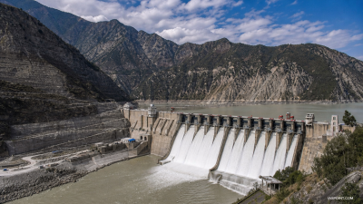
China’s 60,000 MW Medog Hydropower Station on the Yarlung Tsangpo (upper Brahmaputra) is under construction atop the active Paizhen Fault. A June 2026 geological study found the fault runs beneath the reservoir zone, raising seismic, slope-stability, and downstream safety concerns for India and Bangladesh.
What is the current issue
The Medog Hydropower Station is a run-of-the-river megaproject under construction in Medog County, Nyingchi, Tibet. Formal construction began in 2025 and commercial operations are projected for 2033. A state-linked study has shown the Paizhen Fault runs directly beneath the reservoir area, weakening rock mass and increasing risks of landslides, foundation failure and reservoir-induced seismicity.
Why this matters
- Governance: Transboundary water risk without a comprehensive basin treaty complicates bilateral management and emergency coordination.
- Security: Upstream hydraulic control and potential sudden releases create downstream flood and water-security threats for India and Bangladesh.
- Environment & economy: Altered sediment transport and ecosystem disruption affect agriculture, fisheries and delta stability.
- Disaster risk: Slope failures and landslide-dammed lakes can cause catastrophic outburst floods (LLOFs).
Geological and tectonic context
- Syntaxial bend: The project sits at the Great Bend where the Yarlung Tsangpo shifts direction before entering India. The bend concentrates tectonic strain.
- Paizhen Fault: Active since the Pleistocene and seismically active in the recent past. The northern segment produced a M6.9 event in 2017.
- Rock mechanics: Prolonged fault movement has fractured and weakened rock, reducing bearing capacity and increasing susceptibility to slope failures when saturated.
- Reservoir effects: Water loading and seepage into fractured strata can change stress regimes and trigger reservoir‑induced seismicity (RIS).
Project parameters and engineering features
- Scale: 60,000 MW run-of-the-river complex using five cascade dams and four ~20 km tunnels across the U‑bend to exploit a >2,000 m head.
- Output: Designed to produce over 300 billion kWh annually—roughly three times Three Gorges output—serving about 300 million people.
- Cost: Estimated at c. 1 trillion yuan (≈ USD 137–147 billion); some international reports show higher figures.
- Engineering prescriptions: Standard geotechnical measures—slope reinforcement, retaining structures, grouted foundations and continuous monitoring—are recommended by geologists.
Scientific disclosure and geotechnical vulnerabilities
- Study provenance: Research led by Chengdu University of Technology with China Geological Survey units reported the Paizhen Fault under the reservoir zone.
- Key findings: Fault-run fractures, reduced rock cohesion, high landslide susceptibility, and danger of foundation instability under seismic shaking or prolonged saturation.
- Hazard mechanisms: Earthquakes may initiate slope failures; landslides can form natural dams leading to LLOFs; seepage can destabilise abutments and tunnels.
- Mitigation limits: Engineering measures lower but do not eliminate risk in highly fractured, tectonically active mountain settings.
Downstream transboundary and ecological risks
- Flood risk: Structural failure or controlled sudden releases could inundate Arunachal Pradesh, Assam and Bangladesh, causing mass casualties and infrastructure loss.
- LLOFs and channel blockage: Landslides into the gorge can create temporary lakes that may breach catastrophically downstream.
- Water security: Upstream flow regulation confers strategic leverage; absence of a basin-wide treaty leaves downstream states exposed.
- Ecological impact: Tunnel diversion and flow modification alter sediment load, river morphology and aquatic habitats, with long-term effects on delta processes.
Policy and strategic options for India
- Diplomatic measures: Seek extension and strengthening of existing hydrological-data MoU into a basin-scale agreement with mandatory real-time data sharing, joint impact assessment and emergency protocols. Engage Bangladesh for a common diplomatic front.
- Scientific engagement: Propose joint field studies, shared seismic and hydrological monitoring, and third‑party technical review under neutral institutions or multilateral fora.
- Surveillance and early warning: Expand satellite surveillance (ISRO, SAR and optical), install river gauging and real-time telemetry on Indian tributaries, and integrate with NDMA and state disaster plans.
- Defensive infrastructure: Construct tiered downstream buffer reservoirs and flood-regulation infrastructure in Arunachal Pradesh and Assam to attenuate sudden inflows.
- Disaster preparedness: Map LLOF and flood inundation zones, run community-level evacuation drills, and strengthen communication links across border districts.
- Legal and normative tools: Invoke principles of international water law—equitable utilisation and no significant harm—to press for binding operational rules and liability clauses.
Operational and institutional actions
- Inter-agency coordination: Form a dedicated task force comprising MEA, Defence, MoWR, NDMA, ISRO, Geological Survey of India and state governments to monitor developments and plan responses.
- Capacity building: Fund cross-border scientific exchanges, training in mountain geotechnics, and community resilience programmes in the Brahmaputra basin.
- Contingency financing: Prepare budgetary allocations for rapid infrastructure repair, relief and rehabilitation in worst‑case scenarios.
Assessment of trade-offs
- Energy vs risk: The project promises massive clean electricity but lies in a high-risk tectonic zone; economic returns must be weighed against potential loss from a catastrophic failure.
- Environmental cost: Large-scale diversion and tunnelling in an ecologically sensitive gorge threaten biodiversity and sediment flows critical for downstream agriculture and deltas.
- Strategic balance: India must combine hard infrastructure, diplomatic pressure and regional cooperation to reduce asymmetric downstream risk.
Model Questions
1. Analyse the geological risks of building large-scale hydropower infrastructure on active faults in the eastern Himalaya, with reference to the Paizhen Fault and the Medog Hydropower Station. [GS-III: Environment & DM]
A 60–70 word answer: The eastern Himalaya is highly strained from India‑Eurasia collision; active faults like Paizhen produce earthquakes and fracture rock. Building large dams here raises risks: weakened foundations, slope failures, landslides, reservoir‑induced seismicity and LLOFs. Mitigation requires detailed geotechnical investigation, slope reinforcement, seepage control, continuous seismic monitoring and conservative design margins; residual risk persists due to tectonic unpredictability and fracture networks.
2. Discuss the hydro‑diplomatic challenges India faces from China’s unilateral construction of mega‑dams on the Yarlung Tsangpo and possible diplomatic measures to manage downstream risks. [GS-II: International Relations]
A 60–70 word answer: Challenges include asymmetric control over flows, limited basin governance, and risks of sudden releases. India should strengthen the 2008 hydrological MoU into a binding basin agreement demanding real‑time data, joint impact assessments and emergency protocols. Engage Bangladesh for coordinated diplomacy, seek third‑party technical reviews, and use multilateral fora to institutionalise transparency and liability norms for transboundary projects.
3. Examine downstream hazards for Northeast India from a structural failure at the Medog dam and recommend disaster mitigation measures. [GS-III: Environment & DM]
A 60–70 word answer: Failure could produce catastrophic floods, inundate riverine settlements, destroy infrastructure and trigger LLOFs from landslides, threatening millions. Mitigation: develop real‑time early warning linked to river gauging and satellites; build downstream buffer storage; prepare inundation and evacuation maps; strengthen NDMA and state disaster response; conduct community drills; and formalise cross‑border emergency data sharing with China and Bangladesh.
4. Evaluate the economic and environmental trade‑offs of mega run‑of‑the‑river projects in sensitive mountain ecosystems, using the Medog project as an example. [GS-III: Economic Development]
A 60–70 word answer: Mega run‑of‑the‑river projects offer large low‑carbon power and regional development but incur high environmental and social costs in fragile mountains: habitat loss, altered sediment regimes, erosion and risk of catastrophic failure. Economic viability must factor long‑term maintenance, disaster liability and ecosystem services. Policy should insist on rigorous EIA, independent risk assessment, adaptive management and compensation mechanisms before approval.
Last Modified: July 13, 2026