
These are constructed and maintained by the State Public Works Department (PWD) and join the state capitals with district headquarters and other important towns. These roads are also connected to the national highways. The total length of state roadways in India was 1,54,522 km in 2013. These roads constitute only 4 per cent of total length of all roads.
District Roadways
These road in the world connecting Chandigarh to Manali and further to Ladakh. This road traverses an average altitude of 4270 metres above sea level and crosses the passes at altitudes varying from 4875 to 5485 metres. Since its inception in 1960 till March 2005, it has completed 40,450 km of formation works, surfaced 35,577 km of roads, and constructed permanent bridges. These roads have increased accessibility in areas of difficult terrain and hence have helped in economic development also. These roads join the district headquarters with the other places of the district. Their total length is nearly 4,70,000 km. They account for 14 per cent of the total road length of the country.
Rural Roads
Rural roads connect the village with the neighbouring towns and cities. These are generally dusty tracks. Efforts have been made in the recent past to connect the villages with metalled roads. Presently, they account for 80% of total road length of the country.
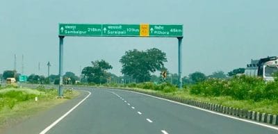
Border Roads
Border Roads Development Board was set up in May, 1960 for accelerating economic development and strengthening defence preparedness through rapid and co-ordinated improvement of roads in the border areas. This organisation has built the highest Special Accelerated Road Development Programme for North Eastern region (SARDP-NE) It envisages improvement of road connectivity to the State Capitals with District Headquarters in the North Eastern region. e proposed programme includes improvement of 10,141 km of roads comprising National Highways (4798km) and state roads (5343 km), to be implemented under Phase-A, Phase ‘B’ and Arunachal Pradesh Package for Road & Highways. Phase-A now consists improvement of 2041 km of National Highways and 2058 km of State Roads. Phase-B has now been modified to cover 2 laning of 1285 km of NHs and 2 laning improvement of 2438 km of State roads for preparation of Detailed Project Reports (DPRS). Arunachal Pradesh Package of roads & Highways comprises of 1472 km of National Highways and 847 km of State Roads.
Water Transport
Waterways had been an important mode of transport for both passenger and cargo tract in India. It includes inland waterways and seaways. There are some navigable canals also which serve as inland waterways. Buckingham canal in Andhra Pradesh and Tamil Nadu is one such canal which provides water transport for a distance of 413 km. e other navigable canals are in Cumberjua, Kurnool, Cuddapah and Midnapur.
Inland Waterways
Inland waterways were the chief mode of transportation before the advent of railways. Waterways are the cheapest means of transport and are most suitable for carrying heavy and bulky materials having low specific cost. It is fuel-efficient and environment-friendly mode of transport. Water transport suffered a great deal at the hands of roads and rail ways because they could not compete with the speed of road and rail transport. Although efforts are being made to revive the inland waterways, yet this mode of transportation is at its initial stage. Waterways provide only one per cent of total transport of India. The total length of navigable waterways in India is 14,500 km which comprises rivers, canals, backwaters, creeks etc. at present, however, a length of 3,700 km of major rivers is navigable by mechanised cracks but the length actually utilised is only about 2000 km. As regards canals, out of 43,000 km of navigable canals, only 900 km is suitable for navigation by mechanised cracks. It shows that the inland waterways are greatly under-utilised. Rivers of South India are seasonal and are not much suited for navigation. However, the deltaic areas of Godavari, Krishna and Mahanadi, lower reaches of Narmada and Tapi, backwaters of Kera, Mandavi and Juari rivers of Goa serve as waterways. Godavari is navigable up to a distance of 300 km from its mouth.
Oceanic Routes
India has a vast coastline of about 7,516 km and over two million square kilometres of Exclusive Economic Zone. Shipping provides transport facilities in this vast coastal tract. The entire coastline is studded with 13 major ports and 200 minor and intermediate ports. About 95 per cent of the overseas trade is moved by the seaways. Coastal shipping also carries domestic tract.
Last Modified: April 16, 2026