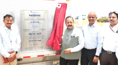
On May 29, 2026, India inaugurated its first SkyCast System at the Indira Gandhi International (IGI) Airport in New Delhi. This advanced aviation weather monitoring facility makes India the 19th country globally to deploy such an integrated atmospheric remote sensing framework. Developed under the Ministry of Earth Sciences’ Mission Mausam, SkyCast aims to reduce weather-related flight delays, cancellations, and diversions. The system delivers real-time intelligence on fog, turbulence, visibility, and wind dynamics. It shifts Indian aviation toward a fog-free and weather-smart operational model.
Operational Framework and Aviation Benefits
The SkyCast system serves as a real-time meteorological intelligence platform. It assists pilots, air traffic controllers, and airport operators in making rapid operational decisions.
- Rapid Nowcasting: It generates short-term weather forecasts updated every five minutes. The platform provides actionable advance alerts within a three-hour window.
- Hazard Detection: The platform identifies critical aviation threats. These include wind shear, temperature inversions, icing, low-level jets, and sudden turbulence.
- Runway-Specific Alerts: It generates localized warnings tailored to specific operational requirements on the tarmac. This helps authorities decide the safest time for take-offs and landings.
- Data Integration: The system uses the VizAir software suite. This software consolidates atmospheric data into visual analytics for meteorologists and operational teams.
Integrated Atmospheric Remote Sensing Technologies
SkyCast utilizes a multi-sensor setup to scan the atmosphere. It tracks thermodynamic profiles up to 10 kilometers in altitude.
| Sensor / Technology | Primary Function | Operational Range / Features |
| Radar Wind Profiler (RWP) | Acts as the core instrument to measure wind speed, direction, and vertical velocity. | Scans up to 3 kilometers above the airport during aircraft descent and landing phases. |
| Ground-based Fog Aerosol Spectrometer (GFAS) | Analyzes fog droplets and pollution particles (aerosols). | Monitors how particulate matter interacts with moisture to thicken winter fog. |
| CL61 Lidar-based Ceilometer | Tracks cloud formation and the vertical structure of fog layers. | Continuously evaluates changing visibility conditions in real-time. |
| Microwave Profiling Radiometer (MPR) | Conducts thermodynamic profiling of the atmosphere. | Assesses temperature and humidity profiles up to 10 kilometers in altitude. |
| SODAR (Sonic Detection and Ranging) | Measures wind scattering using sound waves. | Delivers near-surface high-resolution wind observations. |
| Automated Weather Stations (AWS) | Captures standard ground-level meteorological parameters. | Measures surface temperature, rainfall, and immediate humidity. |
Scientific Foundation: Winter Fog Experiment (WiFEX)
The technological architecture of SkyCast stems from the Winter Fog Experiment (WiFEX).
- Launch and Execution: The Indian Institute of Tropical Meteorology (IITM) and the India Meteorological Department (IMD) jointly initiated WiFEX in 2015.
- Core Research: The project studied fog formation, aerosol-cloud interactions, and severe visibility reduction in urban settings like Delhi.
- Practical Translation: Experimental findings from WiFEX provided the baseline algorithms and sensor requirements. These were necessary to build the commercial and operational SkyCast framework.
Alignment with Mission Mausam
SkyCast is a direct outcome of Mission Mausam. The Union government launched this overarching scheme to modernize India’s weather forecasting infrastructure.
- Capacity Building: The mission aims to install advanced observation networks. This includes 53 Doppler Weather Radars and mini-High Performance Computing Systems (HPCS) across India.
- Expansion Plan: The government plans to deploy the next SkyCast facility at the upcoming Jewar Airport in Uttar Pradesh. The long-term goal is to cover other major airports across the country.
- Broader Applications: SkyCast gathers massive amounts of atmospheric data. Under Mission Mausam, this data will support artificial intelligence-enabled urban weather prediction, transport advisories, and disaster response planning.
IASPOINT Booster Facts for UPSC
- Global Parity: Similar advanced atmospheric profiling systems operate at London Heathrow, John F. Kennedy (USA), Hong Kong, and Singapore Changi airports.
- Space Agency Use: NASA and Cape Canaveral use similar remote sensing equipment for launch weather monitoring.
- Compliance: SkyCast alerting systems align with the standards of the International Civil Aviation Organization (ICAO) and the US Federal Aviation Administration (FAA). This includes its Integrated Wind Shear Alerting System (IWAS) outputs.
- Lead Agencies: The Ministry of Earth Sciences (MoES) oversees the project. It is executed in collaboration with IITM, IMD, and airport operators like Delhi International Airport Limited (DIAL).
- Nowcasting: It refers to weather forecasting on a very short term, usually up to 2 to 6 hours. This is the primary utility of SkyCast for aviation management.