During the 19th and early 20th centuries, the British East India Company and the British Crown transitioned from a regional mercantile power into the undisputed sovereign of the Indian subcontinent. This absolute political authority was driven by the doctrine of Paramountcy—the assertion that British power was supreme and all other states were subordinate. As paramountcy was consolidated internally over the princely states, the British faced the challenge of defining and securing the outer geographical edges of their empire. This led to aggressive frontier expansion. Unlike traditional Indian empires that maintained fluid, fluctuating border zones, the British introduced the European concept of fixed, scientifically surveyed, and heavily fortified international boundaries. The drive to expand and secure these frontiers was heavily influenced by the Great Game—the intense geopolitical rivalry between the British and Russian Empires for dominance over Central and South Asia.
The Two Competing Frontier Strategies
British administrators and viceroys were divided into two schools of thought regarding how the frontiers should be managed and expanded under Paramountcy.
The Forward School
Proponents of this school (such as Lord Wellesley, Lord Lytton, and Lord Curzon) argued that Great Britain must proactively push its military frontiers outward beyond India’s geographical boundaries. They advocated for the active subjugation of neighboring states (like Afghanistan, Burma, and Tibet) to intercept external threats—specifically Russian or French advance—long before they reached the core plains of India.
The Stationary (or Close-Border) School
Advocated by statesmen like Sir John Lawrence, Lord Mayo, and Lord Northbrook, this school championed a policy of non-interference. They argued that expanding beyond natural geographical barriers like the Indus River or the Himalayan crests was financially ruinous and militarily dangerous. They preferred consolidating internal administration and maintaining friendly, independent buffer states without direct military occupation.
Impact on Northwest Frontiers: Afghanistan and Baluchistan
The Northwest frontier was the most strategically sensitive zone due to its historical vulnerability as an invasion route into India.
Geopolitical Subjugation
To secure this frontier, the British launched multiple Anglo-Afghan Wars. While they failed to permanently annex the mountainous terrain due to fierce tribal resistance, the Treaty of Gandamak (1879) successfully brought Afghanistan’s foreign policy under direct British control. This converted the country into a highly controlled buffer state.
Creation of the Durand Line (1893)
To permanently fix the frontier, Sir Mortimer Durand negotiated the demarcation of the Durand Line between British India and Afghanistan. This artificial boundary split the ethnic Pashtun tribal belts in half, planting the seeds for long-term geopolitical and tribal instability that persists to this day.
Tactical Annexation of Sindh (1843) and Punjab (1849)
To gain immediate logistical access to the Northwest passes, the British aggressively annexed Sindh and the Sikh Empire. This extended direct British administrative boundaries all the way to the edges of the Suleiman and Hindu Kush mountain ranges.
Impact on Northern Frontiers: Nepal, Bhutan, and Tibet
The northern expansion was aimed at converting the rugged Himalayan range into an impassable geopolitical firewall against China and Russia.
The Territorial Slicing of Nepal
Following the Anglo-Nepalese War, the Treaty of Sugauli (1816) stripped Nepal of one-third of its territory, annexing the highly strategic hill stations of Kumaon and Garhwal. This linked British territories directly to Central Asian trade routes while transforming Nepal into an isolated, loyal buffer state.
The Extraction of the Dooars from Bhutan
Through the Treaty of Sinchula (1865), the British forcefully annexed the 18 fertile land passes known as the Dooars from Bhutan, alongside Kalimpong. This completely cut Bhutan off from the plains of India, locked its foreign policy under British guidance, and opened vast new tracts for British tea plantation monopolies.
The Breaching of Tibet (1904)
Lord Curzon ordered the military invasion of Tibet under Colonel Francis Younghusband. The resulting Treaty of Lhasa forced Tibet to open trade marts and exclude all other foreign powers. This culminated in the Simla Convention of 1914, where Sir Henry McMahon drew the McMahon Line, shifting India’s northeastern frontier across the crest of the Himalayas to annex the Tawang tract.
Impact on Eastern Frontiers: Assam and Burma
The expansion along the eastern frontier was driven by the commercial motives of British merchants and the need to preempt French expansion from Indochina.
Systematic Eradication of the Burmese Empire
Through three successive Anglo-Burmese Wars (1824, 1852, and 1885), the British systematically dismantled the Konbaung Dynasty. The frontier was pushed from Bengal across the Irrawaddy delta, culminating in the absolute annexation of the entirety of Burma.
Subjugation of Tribal Hinterlands
The expansion into Assam and Burma brought the British into direct conflict with independent frontier tribes such as the Nagas, Kukis, Chins, and Lushais. The British used brutal “pacification” military campaigns to subdue these tribes, creating administrative boundaries like the Inner Line Permit (ILP) system to separate the tribal hill tracts from the revenue-yielding plains.
Administrative Integration
Burma was annexed and integrated as a province of British India, completely altering its historic political identity until its administrative separation in 1937.
Summary of Structural Frontier Impacts
| Target Frontier Zone | Key Boundary / Treaty | Primary Annexed / Impacted Territory | Long-Term Strategic Outcome |
| Northwest Frontier | Durand Line (1893) | Baluchistan, Khyber Pakhtunkhwa, Peshawar | Established a permanent military frontier; artificially divided Pashtun lands. |
| Northern Frontier | Treaty of Sugauli (1816) | Kumaon, Garhwal, Shimla, Darjeeling | Secured high-altitude hill stations for British troop stations; stabilized the Himalayan barrier. |
| Northeast Frontier | McMahon Line (1914) | Tawang, North-East Frontier Tract (Arunachal) | Pushed the frontier to the Himalayan watershed; created long-term boundary disputes with China. |
| Eastern Frontier | Treaty of Yandabo (1826) | Assam, Manipur, Arakan, Tenasserim coast | Opened up the Northeast for lucrative tea, timber, and oil extraction industries. |
Broader Socio-Economic and Political Legacies
The frontier expansion under the banner of Paramountcy had profound effects on the history of modern India.
Creation of Artificial Boundaries
The British drew frontier lines based primarily on military strategy and European balance-of-power geopolitics, completely ignoring the ethnic, linguistic, and cultural continuities of the local populations. This created post-colonial border flashpoints across South Asia (such as the Durand Line dispute and the Sino-Indian border dispute over the McMahon Line).
Economic Resource Exploitation
Every frontier expansion opened up new economic frontiers. The annexation of the Assam and Bengal Dooars, Kalimpong, and the Burmese delta allowed British capitalists to clear vast forests for highly profitable tea plantations, timber logging, and mineral extraction.
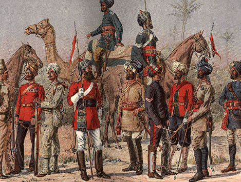
Rise of the Martial Races Theory
To defend these newly acquired, highly volatile frontiers, the British restructured the Indian Army. They marginalized communities that participated in the 1857 mutiny and heavily recruited from frontier regions, institutionalizing the discriminatory “Martial Races” theory to enlist Gorkhas, Sikhs, Pathans, and Garhwalis.
The “Buffer State” Legacy
The expansion successfully insulated core British India from direct conflict with other global empires (Russia and France). It surrounded the subcontinent with a protective ring of loyal, dependent buffer entities (Nepal, Bhutan, Tibet, and Afghanistan), a geopolitical framework that India’s post-independence foreign policy continued to navigate.
Last Modified: June 9, 2026