
Geography in the Indian context has evolved from ancient cosmological descriptions in the Puranas to a rigorous social and physical science during the post-independence era. Indian geographers have significantly contributed to land-use studies, regional planning, and the understanding of the Indian Monsoon.
Ancient and Medieval Foundations
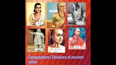
Aryabhata (476–550 CE)
- Geocentric Observations: He proposed that the Earth is spherical and rotates on its axis.
- Mathematical Geography: Calculated the Earth’s circumference with high accuracy ($24,835$ miles).
- Scientific Reasoning: Provided the first scientific explanation for solar and lunar eclipses, attributing them to shadows cast by the Earth and Moon rather than mythological demons.
Varahamihira (505–587 CE)
- Pancha-Siddhantika: Contributed to the understanding of mathematical astronomy and geography.
- Hydrology and Ecology: In his work Brihat Samhita, he discussed the relationship between vegetation and groundwater levels, a precursor to modern hydro-geographical studies.
Pioneers of Modern Indian Geography
S.P. Chatterjee (Shiba P. Chatterjee)
- The Father of Indian Geography: He was instrumental in establishing geography as a distinct academic discipline in India.
- National Atlas and Thematic Mapping Organization (NATMO): He served as the first Director of NATMO and was the chief architect of the first National Atlas of India (1957).
- International Recognition: He was the first Indian to be elected President of the International Geographical Union (IGU) in 1964.
- Physiographic Classification: He provided the most detailed classification of India’s physiographic regions, which is still the basis for many UPSC-level geographical studies.
R.L. Singh (Ram Lochan Singh)
- Regional Geography: Known for his seminal work India: A Regional Geography (1971).
- Rural Settlement Geography: He pioneered the study of Indian villages, analyzing their morphological structure and evolutionary stages.
- The “Varanasi School”: He transformed Banaras Hindu University (BHU) into a global hub for settlement geography and regional studies.
Enayat Ahmad
- Geomorphology and Coastal Studies: Renowned for his work on the coastal geomorphology of India and the evolution of the Indo-Gangetic plains.
- Social Geography: He authored extensive works on the social geography of Bihar and the wider Indian subcontinent, focusing on the intersection of physical landscape and human settlement.
Key Contributors to Spatial and Economic Geography
Moonis Raza
- Regional Development: A founding father of the Center for the Study of Regional Development (CSRD) at JNU.
- Political Geography: He analyzed the spatial manifestations of colonialism in India and worked extensively on the geography of education and labor.
L.S. Bhat
- Regional Planning: He is credited with integrating geographical techniques into India’s Five-Year Plans.
- Spatial Analysis: Bhat specialized in the hierarchy of settlements and the concept of “Growth Poles” within the Indian economic context.
C.D. Deshpande
- Regional Personality: Focused on the “Geography of Maharashtra” and the concept of the regional personality of landscapes.
- Urban Geography: Contributed heavily to the understanding of urban sprawl and the functional classification of Indian cities.
Comparison of Major Contributions
| Geographer | Primary Field of Contribution | Key Work/Organization |
| S.P. Chatterjee | Physiography & Cartography | National Atlas of India; IGU President |
| R.L. Singh | Regional & Settlement Geography | India: A Regional Geography (1971) |
| Moonis Raza | Regional Development | CSRD, JNU; Geography of Education |
| Enayat Ahmad | Geomorphology | Coastal Geography of India |
| V.L.S. Prakasa Rao | Urban and Regional Planning | Growth Poles and Growth Centres |
| M. Shafi | Agricultural Geography | Land Utilization in Eastern Uttar Pradesh |
Specialized Domains in Indian Geography
Agricultural Geography: Mohammad Shafi
- He focused on food security and land-use efficiency.
- Applied the “Nutrition-based approach” to evaluate the agricultural productivity of various Indian states.
Oceanography and Polar Studies: S.Z. Qasim
- While primarily a marine biologist, his contributions to Indian Marine Geography are unmatched.
- First Indian Antarctic Expedition: He led the first expedition to Antarctica in 1981, establishing India’s presence (Dakshin Gangotri) in the polar regions.
UPSC Trivia and Fact-Files
- Bhuvan Portal: Developed by ISRO, it is the modern digital face of Indian Geographical Data, continuing the legacy of cartography started by S.P. Chatterjee.
- Survey of India: Established in 1767, it is the oldest scientific department of the Government of India, responsible for the initial mapping of the Great Trigonometrical Survey.
- The Concept of “Desh”: Ancient Indian geographers used the term Desh to describe a region with distinct physical and cultural characteristics, a concept that parallels the Western “Pays” in French geography.
- Indian Monsoon Research: Modern geographers like Sulochana Gadgil have bridged the gap between meteorology and geography by studying the Tropical Convergence Zone (TCZ) and its impact on Indian agriculture.