The Kamata Kingdom emerged in the mid-thirteenth century as a powerful sovereign entity in northeastern India, filling the political vacuum left by the disintegration of the ancient Kamarupa Empire. Geopolitically, it operated across three highly interconnected zones:
- The Eastern Region (The Alluvial Core): Encompassed the western Brahmaputra Valley, northern Bengal, and the plains along the Dharla, Teesta, and Sankosh rivers. This region served as the agricultural engine and demographic center of the state.
- The Western Region (The Bengal Sultanate Interface): The highly volatile frontier stretching along the Karatoya River. This river historically served as the political boundary dividing the Hindu kingdoms of the northeast from the Islamic polities of the Bengal Sultanate and the Delhi Sultanate.
- The Frontier Highlands (Tribal Peripheries): Included the rugged mountain foothills bordering Bhutan, Tibet, and the Garo and Khasi hills. These tracts required active diplomatic and military management to regulate trans-frontier trade routes and contain tribal raids.
The Khen Dynasty (circa 1440–1498 CE)
Following the rule of early medieval chieftains (Bhuyans), the Khen Dynasty consolidated absolute authority over Kamata. Founded by Niladhwaj Khen, an indigenous ruler who displaced traditional elite lineages, the dynasty successfully synthesized tribal socio-political structures with mainstream administrative models. The Khens shifted the primary political center to Kamatapur (modern Gosanimari in Cooch Behar), transforming it into a heavily fortified urban complex.
Military Engineering and Frontier Conflicts
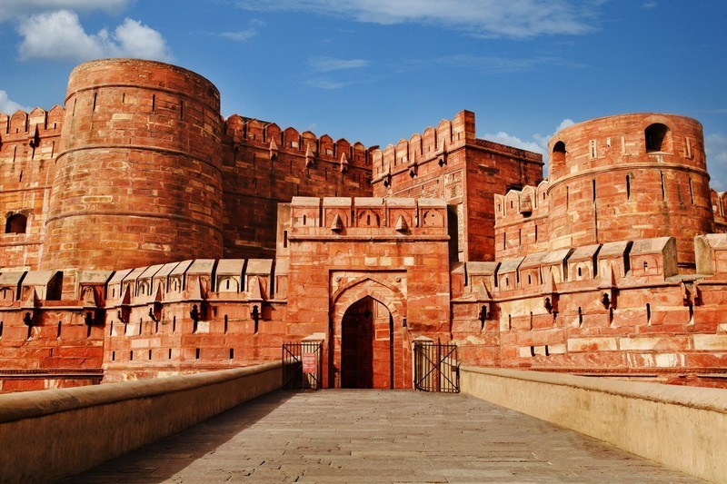
Defensive Infrastructure of Kamatapur
The capital city of Kamatapur was a marvel of medieval military engineering, designed specifically to withstand prolonged sieges by cavalry-dominated armies from northern India. The city was protected by massive concentric earthen ramparts (Gars) measuring nearly 15 miles in circumference, flanked by deep defensive moats filled with water from the Dharla River.
The Western Frontier Wars with the Bengal Sultanate
The history of Kamata was defined by its resistance to expansionist Islamic dynasties from the west. The kingdom faced multiple invasions due to its strategic position as the gateway to the Brahmaputra Valley and the silk routes of Tibet:
- Invasion of Ghiyasuddin Iwaj Khilji (1226 CE): An early military incursion from Bengal that was successfully repelled by the regional forces using riverine ambush tactics.
- The Campaign of Shamsuddin Ilyas Shah (1350s CE): A major western push that forced the Kamata rulers into temporary retreats but failed to establish permanent Islamic administration.
- The Fall of Kamatapur (1498 CE): Alauddin Husain Shah, the Sultan of Bengal, launched a massive, multi-year siege against the last Khen ruler, King Nilambar. By cutting off supplies and exploiting internal treachery involving the king’s minister, Husain Shah breached the walls of Kamatapur, destroyed the Khen lineage, and temporarily annexed the western frontier up to the Hajo region.
| Chronological Era | Key Ruling Dynasty / Sovereign | Major Frontier Conflicts | Geopolitical Outcome | | | | | | | Mid-13th Century | Sandhya (Kamateswar) | Shifted capital from Kamarupanagara westward to Kamatapur | Insulated the core state from early Delhi Sultanate raids. | | Mid-15th Century | Niladhwaj Khen (Founder, Khen Dynasty) | Subjugation of regional Bhuyan chieftains | Unified western Assam and northern Bengal under centralized rule. | | Late 15th Century | Nilambar Khen (Last Khen Sovereign) | Siege of Kamatapur by Alauddin Husain Shah (1498 CE) | Fall of the Khen Dynasty; brief Islamic occupation of western Kamata. | | Early 16th Century | Biswa Singha (Founder, Koch Dynasty) | Overthrew Muslim governors and unified the frontier | Transition of the Kamata region into the Koch Kingdom. |
Institutional Framework and Economic Resources
Administrative Hierarchy
The Kamata Kingdom maintained a centralized monarchy supported by a council of hereditary ministers. The state divided its territory into administrative units called Chaklas, which were overseen by military governors tasked with tax collection and frontier defense. The village administration was led by Gaonburhas (village headmen) who resolved local civil disputes using customary laws.
Agrarian Economy and Transit Revenue
The financial stability of Kamata relied on wet-rice cultivation (Sali paddy) in the river valleys. The state managed an extensive network of embankments to regularize irrigation and check seasonal floods. Additionally, the kingdom generated substantial revenue through transit duties (Dauka) levied at trading outposts along the Karatoya and Brahmaputra rivers.
Export Monopolies and International Trade
Kamata acted as a vital trading hub connecting Bengal with Bhutan, Tibet, and China. The state controlled monopolies over highly lucrative export commodities:
- War Elephants: Sourced from the northern forest tracts and exported in large numbers to the cavalry-starved Sultanates of Bengal.
- Agarwood and Musk: Sourced from the sub-Himalayan frontier zones, highly valued in luxury and medicinal markets across Asia.
- Endi and Muga Textiles: High-grade wild silk fabrics produced by local weaving guilds.
Socio-Religious Transformation and Cultural Syncretism
Patronage of Kamakhya and Tantric Cults
The Kamata kings used religion to legitimize their rule over a highly diverse populace of indigenous tribes and Aryanized settlers. The state actively patronized the Kamakhya Temple cult at Nilachal Hill, blending tribal fertility rituals with classical Puranic Tantrism. The rulers assumed the grand title of Kamateswar (Lord of Kamata), projecting themselves as divine deputies of the goddess Kamakhya.
Early Vernacular Literary Proliferation
The Kamata court was a major center for early Assamese and Bengali literature, breaking the monopoly of Sanskrit scholarship. King Durlabh Narayan (fourteenth century) famously patronized pioneering vernacular poets, including Hema Saraswati, who composed the Prahlada Charita, and Harihara Vipra, who wrote the Asvamedha Parva. This state-sponsored literary tradition laid the foundational syntax for modern Assamese literature.
High-Yield Facts for UPSC Prelims
The Title “Kamateswar”
Every ruler of the Kamata Kingdom, regardless of dynasty, assumed the official title Kamateswar (or Kamatesvari for queens) in their epigraphs and land charters, establishing a continuous administrative identity that outlasted individual ruling houses.
The Gosanimari Excavations
The historical ruins of Kamatapur are located at Gosanimari in the Cooch Behar district of West Bengal. Modern archaeological excavations have revealed massive stone structures, brick temples, and the remains of the water-gate system used by the Khen kings to manage the flow of the Dharla River.
The “Kamata-Kamrup” Distinction
In medieval historiography and Islamic chronicles like the Tabaqat-i-Nasiri and Baharistan-i-Ghaibi, the region is explicitly referred to as “Kamrud” or “Kamata,” marking its political separation from the ancient classical boundaries of Pragjyotisha.
Transition to the Koch Kingdom
The political space of the Kamata Kingdom served as the direct structural foundation for the Koch Dynasty. Following the withdrawal of the Bengal Sultanate’s forces due to local rebellions, Biswa Singha united the Mech and Koch clans, overthrew the remaining Muslim governors, and assumed the title of Kamateswar, directly transforming the remnants of Kamata into the Koch Empire.
Last Modified: June 22, 2026