The Kingdom of Mewar, ruled primarily by the Guhilot and Sisodia dynasties, occupied a critical geopolitical position in south-central Rajasthan. In the context of medieval Indian history, its administrative and military operations extended across a distinct regional triad:
- The Eastern Region (The Plains Core): Encompassing the fertile plains of Mewar, including Chitor (Chittorgarh) and Udaipur, along the Banas River basin. This area served as the agricultural engine, demographic core, and political nerve center of the state.
- The Western Region (The Desert Interface): Bordering the arid tracts of Marwar (Jodhpur) and Godwar along the Aravalli Range. This frontier functioned as a volatile zone of diplomatic alignments, inter-clan rivalries, and territorial buffer management.
- The Frontier Highlands (Tribal Peripheries): Comprising the rugged Bhil and Meena tribal tracts of the southern and western Aravallis, extending toward Mewar’s outer frontiers with Gujarat and Malwa. This region provided strategic natural fortresses and specialized guerrilla warfare forces.
Topographical Factors in Strategy and Fortification
Mewar’s administration was deeply integrated with the rugged topography of the Aravalli Range. The terrain dictated a defensive military strategy centered on hilltop fortresses and narrow mountain passes (Naals). This geographic positioning allowed Mewar to resist expansionist empires from Delhi, Malwa, and Gujarat by neutralizing large cavalry and artillery forces through localized mountain and guerrilla warfare.
Key Dynasties, Sovereigns, and Imperial Consolidation
The Guhilot Foundations and Bappa Rawal
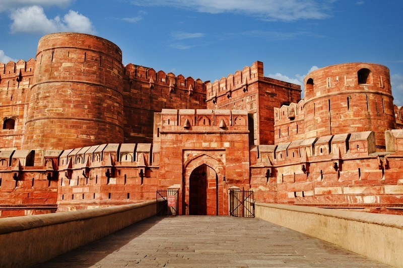
The state of Mewar was founded in the 6th century CE by Guhaditya, but its sovereign imperial consolidation began under Bappa Rawal (reign c. 734–753 CE). Bappa Rawal captured the strategic fortress of Chittorgarh from the Mori Rajputs. He established a unified regional polity that checked early Arab Umayyad incursions along the western frontier of India, securing Mewar’s status as a premier military power.
The Sisodia Resurgence under Rana Hammir
Following the sack of Chittorgarh by Alauddin Khalji in 1303 CE, which ended the Rawal branch of the Guhilots, Rana Hammir (reign 1326–1364 CE) established the Sisodia branch of the dynasty. Hammir recaptured Mewar, defeated the forces of the Delhi Sultanate at the Battle of Singoli, and assumed the title of Maharana. He reorganized the administrative machinery to unify the eastern plains and western borderlands.
Expansion under Rana Kumbha and Rana Sanga
- Rana Kumbha (reign 1433–1468 CE): A polymath military strategist who fortified Mewar’s frontiers by building a network of 32 major forts, including Kumbhalgarh. He defeated the combined Muslim armies of the Malwa and Gujarat Sultanates, commemorating his victories by erecting the Vijay Stambha (Tower of Victory) at Chittorgarh.
- Rana Sanga (reign 1508–1528 CE): Reached the peak of Mewar’s multi-regional hegemony by uniting various Rajput clans into a powerful confederacy. He fought major battles against Ibrahim Lodi (Battles of Khatoli and Dholpur) and Babur (Battle of Khanwa, 1527 CE), briefly establishing Mewar as a dominant power across northern and central India.
Resistance under Maharana Pratap
Following Akbar’s siege and capture of Chittorgarh in 1567–1568 CE, Maharana Pratap (reign 1572–1597 CE) shifted the political center of the kingdom deeper into the western Aravalli highlands, establishing a temporary capital at Chavand. He fought the Mughal army at the Battle of Haldighati (1576 CE) and successfully reclaimed most of Western and Central Mewar through persistent guerrilla warfare and structural military-tribal alliances. | Sovereign | Major Battles | Frontiers Managed | Key Geopolitical & Cultural Outcome | | | | | | | Bappa Rawal | Arab Invasions (c. 730s) | Western Desert Frontier | Captured Chittorgarh; checked early Arab expansion into northwestern India. | | Rana Hammir | Battle of Singoli (c. 1336) | Northern/Delhi Frontier | Founded the Sisodia branch; restored sovereignty after the Khalji occupation. | | Rana Kumbha | Battle of Sarangpur (1437) | Southern/Malwa-Gujarat Border | Fortified frontiers with 32 fortresses; constructed the Vijay Stambha. | | Rana Sanga | Battle of Khanwa (1527) | Central Indian Frontier | Led the Rajput Confederacy against early Mughal rule. | | Maharana Pratap | Battle of Haldighati (1576) | Western Aravalli Highlands | Reclaimed lost territories using high-altitude guerrilla warfare. |
Administrative Infrastructure and Resource Mobilization
The Feudal Structure and Nobles’ Hierarchy
Mewar maintained a decentralized administrative framework based on a hereditary clan-feudal structure. The land was divided into crown lands (Khalsa) administered directly by royal officials, and feudal estates (Jagirs) assigned to Rajput chieftains (Thakurs) in exchange for military service and revenue collection. The nobility was strictly organized into structural classes that determined court protocol and frontier military positions:
- The Solah (The Sixteen): The first-class nobles who held the largest estates and sat closest to the Maharana in council. They were responsible for defending major frontier outposts.
- The Battis (The Thirty-Two): The second-class nobles who managed sub-regional defense sectors and judicial matters in times of peace.
- The Gol (The Minor Chieftains): A fluid group of lesser feudal landholders who provided immediate cavalry reinforcements during mobilization.
The Patra-Mantri and Judicial Administration
The central executive organ was headed by the Maharana, who held absolute judicial, civil, and military authority as the regent of the state deity. The monarch was assisted by a council of state officials, including the Pradhan (Prime Minister), the Sandhivigrahi (Minister of War and Peace), and the Shri Bhandari (Imperial Treasurer). Judicial administration was decentralized, with local disputes settled by village panchayats and caste councils using traditional customary laws, while the Maharana served as the final court of appeal.
Fiscal Framework and Taxation
Imperial revenue was generated through agricultural assessments, trade customs, and mineral exploitation.
- Bhag and Bhog: The primary agricultural taxes, levied as a share of grain production depending on soil fertility and irrigation access.
- Dani or Dan: Transit duties collected at strategic mountain passes (Naals) and river crossings on commercial caravans moving between the ports of Gujarat and the markets of Delhi.
- Mineral Royalties: Sourced from copper, lead, and silver mines at Zawar, which provided the financial resources needed to purchase war horses and construct massive stone fortifications.
Socio-Religious Governance and Tribal Synthesis
Theocratic Ideology of Eklingji Regency
Mewar introduced a sophisticated political theory of divine regency to preserve political legitimacy and enforce unity among its feudatories. The true sovereign of Mewar was legally declared to be Shri Eklingji (a manifestation of Lord Shiva), while the Maharana functioned merely as the Diwan (Viceroy or prime servant) of the deity. This state-theocracy turned any rebellion against the crown into an act of sacrilege against the state deity, providing structural stability during internal successions and external frontier pressures.
The Bhil-Rajput Military Alliance
The western frontier highlands of Mewar were secured through a strategic socio-military alliance with the indigenous Bhil tribes. Recognizing the Bhils’ mastery over the rugged Aravalli tracks, Mewar monarchs integrated tribal chieftains into the core military apparatus. The Bhils provided vital infantry contingents, intelligence networks, and safe passage through mountain defiles during Mughal incursions. This inter-dependence was formalised by including a Bhil warrior alongside a Rajput warrior on the official state coat of arms of Mewar, symbolizing the structural unity between the valley state and the highland frontier.
Literary and Architectural Patronage
The Mewar court was a center for classical Sanskrit literature and vernacular Rajasthani compositions. Rana Kumbha was himself a scholar of distinction, authoring technical treatises such as the Sangeet Raja and commentary on Jayadeva’s Gita Govinda. The dynasty patronized the creation of formal architectural manuals, including the Prasada Mandana and Rupa Mandana composed by Kumbha’s chief architect, Mandan. These texts provided the architectural blueprints for temple restorations, urban structures, and military installations across western India.
High-Yield Facts for UPSC Prelims
The Title of Maharana
Unlike other Rajput rulers who adopted titles like Raja, Maharaja, or Rao, the sovereigns of Mewar exclusively used the title Maharana (or Rana), signifying their independent status and historical rejection of subservient imperial titles from external Sultanates.
The Zawar Silver Mines
Located near Udaipur, the Zawar mines are historically recognized as one of the oldest zinc and silver smelting sites in the ancient and medieval world. The extensive exploitation of these mines during the reigns of Rana Lakha and Rana Kumbha provided the economic foundation that funded Mewar’s architectural projects and multi-front military campaigns.
The Kirti Stambha Inscriptions
The Vijay Stambha (or Kirti Stambha) at Chittorgarh features detailed Sanskrit stone inscriptions composed by court poets Atri and his son Mahesh. These epigraphs serve as a vital historical record, providing genealogical data, detailing military campaigns against the Sultanates of Malwa and Gujarat, and listing the socio-religious endowments of the Sisodia dynasty.
The Treaty of Mewar (1615 CE)
Concluded between Maharana Amar Singh I (son of Maharana Pratap) and the Mughal Emperor Jahangir (represented by Prince Khurram, later Shah Jahan), this treaty brought an end to decades of warfare. Under its specific terms, Mewar accepted Mughal suzerainty, but with unique concessions: the Maharana was exempted from attending the Mughal court in person, no matrimonial alliance was forced upon the royal house, and Chittorgarh Fort was restored to Mewar on the condition that it would not be refortified.
The Kumpawat-Sisodia Boundary Arbitration
The boundary between the rival kingdoms of Mewar and Marwar was permanently demarcated through the Aonla-Chawla Sandhi (c. 1453 CE), brokered by Hansa Bai. The border was fixed at the areas where the Aonla (emblic myrobalan) trees of Mewar met the Chawla (desert bushes) of Marwar, establishing geographic stability along the western frontier.
Last Modified: June 22, 2026