
An Early Warning System (EWS) is an integrated system of hazard monitoring, forecasting, and prediction, disaster risk assessment, and communication that enables individuals and communities to take timely action to reduce disaster risks. In India, the evolution of EWS has transitioned from simple weather alerts to sophisticated, tech-driven Impact-Based Forecasts (IBF).
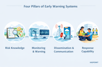
Four Pillars of a People-Centred EWS
According to the United Nations Office for Disaster Risk Reduction (UNDRR), an effective “end-to-end” EWS must comprise four interlinked elements. A failure in any one component renders the entire system ineffective.
- Risk Knowledge: Systematic collection of data and undertaking risk assessments to understand hazards and vulnerabilities.
- Monitoring and Warning Service: Technical capacity to detect, analyze, and forecast hazards (e.g., Doppler Radars, Seismographs).
- Dissemination and Communication: Ensuring warnings reach those at risk via clear, actionable, and redundant channels.
- Response Capability: Education and preparedness of the community to react correctly to the warnings received.
India’s Multi-Hazard Early Warning Decision Support System (MHEW-DSS)
Launched as a flagship initiative under Mission Mausam (2024-2026), the MHEW-DSS represents a paradigm shift in India’s forecasting capabilities. Developed indigenously by the India Meteorological Department (IMD), it leverages WebGIS and automated data processing.
Key Advancements (2026 Status)
- Lead Time Enhancement: Forecast lead times for major events have been extended from 5 days to 7 days.
- Automation: Over 90% of weather data collection and quality checks are now automated, reducing human error.
- Accuracy Improvement: Forecast preparation time has been slashed by 50% (from 6 hours to 3 hours), with a 30% increase in spatial accuracy.
- Geospatial Integration: Uses high-resolution Numerical Weather Prediction (NWP) models to provide ward-level or village-level alerts.
Hazard-Specific Warning Infrastructure in India
| Hazard | Primary Nodal Agency | Key Technology/System |
| Cyclones | IMD | Cyclone Warning Centres (CWCs), INSAT-3DR Satellites. |
| Tsunami | INCOIS (Hyderabad) | BPRs (Bottom Pressure Recorders), Tide Gauges, ITEWC. |
| Floods | Central Water Commission (CWC) | Telemetry-based flood forecasting, GLOF monitoring. |
| Earthquakes | NCS (National Centre for Seismology) | Real-time Seismic Monitoring Network (No prediction possible yet). |
| Forest Fires | Forest Survey of India (FSI) | MODIS and VIIRS satellite data alerts via SMS/Email. |
Dissemination Channels and Last-Mile Connectivity
To bridge the “last-mile” gap, India employs the Common Alerting Protocol (CAP), a geo-targeted system that overrides local mobile networks to send loud, emergency alerts to all handsets in a specific hazard zone.
- Sachet Portal/App: A unified platform for citizens to receive real-time alerts for all hazards based on their GPS location.
- Damini App: Specifically designed for lightning alerts, providing a 15-to-20-minute window for residents to seek shelter.
- Gagan (GPS Aided GEO Augmented Navigation): Used primarily for alerting fishermen deep at sea who are beyond the range of traditional mobile towers.
- NavIC: India’s indigenous satellite navigation system used for broadcasting emergency messages to maritime and remote land areas.
Colour-Coded Warning System
The IMD utilizes a standardized color-coding system to communicate the severity of the threat to the general public and administrators:
- Green (All is Well): No advisory issued.
- Yellow (Be Aware): Severely bad weather is possible; keep a watch on updates.
- Orange (Be Prepared): High risk of weather-related disruption; stay prepared for evacuation.
- Red (Take Action): Extremely bad weather is certain; immediate action required to protect life and property.
Facts and Trivia for UPSC Prelims
- Tsunami Ready Recognition: India is the first country in the Indian Ocean region to achieve the UNESCO-IOC “Tsunami Ready” tag for two villages in Odisha—Venkatraipur and Noliasahi.
- Mission Mausam: A ₹2,000 crore initiative (2024) aimed at creating “Weather-Smart” India through AI-driven forecasting and advanced Doppler Weather Radar (DWR) networks.
- BHISHM Cube: A modular, portable “Emergency Medical Hospital” designed for rapid deployment during the “Golden Hour” following a disaster alert.
- Impact-Based Forecasting (IBF): A shift from telling people “what the weather will be” to “what the weather will do” (e.g., predicting specific bridge collapses or crop damages instead of just rainfall millimeters).